[h=2]Area 51 Groom Lake[/h]

[h=1]Area 51[/h]Military Facility, Social Phenomenon and State of MindArea 51, also known as Groom Lake, is a secret military facility about 90 miles north of Las Vegas. The number refers to a 6-by-10-mile block of land, at the center of which is a large air base the government will not discuss. The site was selected in the mid-1950s for testing of the U-2 spyplane, due to its remoteness, proximity to existing facilities and presence of a dry lake bed for landings. Groom Lake is America's traditional testing ground for "black budget" aircraft before they are publicly acknowledged. The facility and surrounding areas are also associated -- with varying levels of credibility -- with UFO and conspiracy stories. In 1989, Bob Lazar claimed on a Las Vegas television station that he had worked with alien spacecraft at Papoose Lake, south of Area 51. Since then, "Area 51" has become a popular symbol for the alleged U.S. Government UFO cover-up. <small>[GC 8/96]</small>
The page below is an entry point into the largest public database of information on the base and surrounding areas, assembled by the [old] Area 51 Research Center. Much about Area 51 remains a mystery, but here's what we do know.
Title: AREA 51 HIGHWAY SERIOUS BUSINESSSubtitle: Resident fears road's more mundane dangersType: Newspaper articlePublication: Las Vegas SunDate: March 8, 1996Author: Mary ManningArea 51 watcher Glenn Campbell isn't expecting Nevada's new Extraterres- trial Highway" to attract any ETs, but he fears the remote roadway will trap hapless Earth-bound tourists in natural and man-made dangers.Gov. Bob Miller designated State Route 375, running about 100 miles through south-central Nevada, as the "Extraterrestrial Highway" after the state Transportation Board approved the name change in February.South and west of the highway, the Air Force operates the top-secret Groom Lake air base, known as Area 51, where the government has developed such exotic aircraft as the U2 spy plane, SR-71 Blackbird and F-117A Stealth fighter. The base is also thought by many UFO buffs to contain the bodies of aliens recovered from crash sites.The lure of possible UFOs leads many people to hang out on public land around the base, where there is no fence and poor markers to warn them that they are near a sensitive military area, said Campbell, director of the Area 51 Research Center in Rachel, population 100."Instead of accurately portraying this as a harsh desert area, the state is putting an appealing label on it," Campbell said, "making the area seem gentle and attractive instead of dangerous."Campbell has witnessed base security officers confiscating film and video equipment from television crews. He was arrested and convicted of a misdemeanor for obstructing an officer during one media visit.There's danger to visitors from Mother Nature, as well, he said. Or-dinary cars may get stuck in off-road sand or people unfamiliar with the desert may drive into the middle of nowhere without water. Last year, five people died in Southern Nevada's desert areas from heat exposure and lack of water."This has happened to perhaps a half-dozen people in my time here," saidCampbell, who moved to Rachel near the secret military base in 1981.To warn tourists about the hidden dangers in the desert, Campbell asked state officials to post more warning signs with specific dangers, modify the state's trespassing laws and resolve warrantless film seizures by rural sheriff's deputies on behalf of armed guards at the base.Miller appeared on national television Monday to announce the designated highway. The Nevada Transportation Department will post "Extraterres-trial Highway" signs costing $3,300, Miller said, including at least one pointing skyward to welcome any out-of-this-world visitors."The designation of Highway 375 as the Extraterrestrial Highway serves to accentuate the sense of mystery that pervades a stretch of this road," Miller said. "This is a tourist attraction and I don't believe for a minute that anyone visiting the highway and its immediate area should be concerned about being bothered by security personnel." The governor noted that 87 percent of Nevada is owned by the federal govern-ment and the state contains many military installations."So I don't feel there's a need to make a particular issue out of the ET Highway and its immediate public access land area," he said.The Extraterrestrial Highway runs from Hiko to Warm Springs, drawing about 50 vehicles a day. Campbell said he felt responsible for the highway's special designation. In 1993 he published "The Area 51 Viewer's Guide" calling State Route 375 "America's Alien Highway."Although he's camped in the hills surrounding Groom Lake and joins the UFO spotters in Rachel twice a year, Campbell said he has never seen anything unexplainable in the skies above the obscure rural road.###Correction: Campbell moved to Nevada in 1993, not 1981 as statedin article.[h=2]AREA 51, part of the Nellis Air Force Range and Nuclear Test Site, is approximately 80-125 miles North and West of Las Vegas. At Area 51 the U.S. government is test-flying highly secret BLACK PROJECT aircraft for many years, several people think this includes UFOs. They call one part of this military site Groom Dry Lake area. It has been proven the Stealth and SR 71 projects were built and tested at this famous Area 51. Many people refer to this highly secret areas who work in and around this military installation as "Dreamland" or "Skunkworks" or sometimes just called "Groom Lake." [/h]
From Las Vegas take I-15 north for 22 miles. At exit 64 take US-93 north. After 85 miles, 12 miles past Alamo, you come to the intersection with Hwy. 318 on the left. Directly across the road from the intersection, to your right, you will see the ruins of an old casino.
At the intersection turn left onto Hwy. 318, and after less than a mile veer left again onto Hwy. 375. At that intersection you will see the "Extraterrestrial Highway" sign under a group of trees. Ironically, right next to the sign, in the shade of the trees, is where some of the Area 51 workers park their cars to take the white bus into Area 51.
From the beginning of Hwy. 375 it is about 15 miles over Hancock Summit to the beginning of Groom Lake Road, 20 miles to the Black Mailbox and 39 miles to Rachel.
The last gas in Las Vegas is at the Craig Rd. exit. There are a few gas station on the way, in Alamo, Ash Springs, Rachel (only regular unleaded) and Tonopah. However, some of the stretches without gas are over 100 miles, and some of the gas stations close at night. So you may want to keep an eye on your gas.
Please note that most of Hwy. 375 is open range. There are no fences, and cows frequently wander across the road. When you see cows near the road slow down and be prepared to stop. Be especially careful at night, when cows on the road are very hard to see. Running into a cow will not only cause severe damage to your vehicle, but you will also have to reimburse the rancher for the cow.
[h=3]he Significance of Area 51 Imagery[/h]Apart from the simple voyeuristic thrill of gazing upon secret things, which cannot be denied, there is a larger public policy interest in overhead imagery of Area 51. The end of the Cold War has occasioned only modest reforms in the grotesquely hypertrophied security and classification system that insensibly developed as the bodyguard of lies against the Soviet Union. These security measures were not entirely without foundation, as they were implemented to protect American weapons systems from being copied or countered by the Soviet adversary.
But they were not without price, as over time the secret government within the security enclave became increasingly unaccountable to an increasingly distrustful public. With the end of the Cold War, and in the absence of a worthy adversary with the potential to copy or counter American weapons, it was presumed that there would be an adjustment in the security and classification system, towards greater transparency and public accountability.
With some notable exceptions, however, the security enclave remains remarkably unchanged from its Cold War configuration. Indeed, in recent years a backlash has emerged, tending to reverse even the modest gains in public accountability of the 1990s.
Humor is one of the few tools available for public efforts to shift the boundaries of the security enclave. Declining to take "secrets" seriously constitutes a fundamental epistemological critique of a security and classification edifice that does far more to protect bureaucratic interests than to protect the national interest.
Highlighting the discrepancy between what the public knows, and what the government will acknowledge, is a key instrument in teasing out the absurdities of the security enclave. There is no better opportunity for such mirth than Area 51. The US Government has only recently acknowledged the "fact of the existence" of this facility, despite ample publicity and super-abundant speculation over the past decades.
The Good Book says "the guilty flee where none pursueth, but the righteous are bold as a lion" [Proverbs 28:1]. Over time the profound secrecy surrounding Area 51 has engendered an elaborate edifice of popular culture, rehearsed most famously in the movie "Independence Day." Sceptical observers may perhaps be forgiven for suspecting that Area 51 is the repository for captured Alien technology, since it would otherwise be difficult to imagine any other secret so awful as to require the level of secrecy surrounding this facility.
Reducing the excessive secrecy at Area 51, and throughout the government generally, is an essential step towards restoring the bonds between American society and the American government.
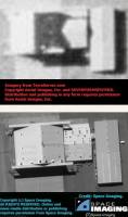
[h=3]Lessons Learned - Public Imagery[/h]Apart from the intrinsic interest in Area 51 itself, overhead imagery of this facility provides important insights into the dynamics of publicly available high-resolution satellite imagery.
The new 1-meter IKONOS imagery provides substantial interpretability gains relative to previously available 2-meter imagery. This fact should be self-evident from the simple physical reality that a single pixel in a 2-meter image is revealed as four pixels in a 1-meter image. If it is not self evident, contemplation of Area 51 at various resolutions should prove enlightening.
If one picture is worth a thousand words, two pictures are worth ten thousand words. The availability of new 1-meter imagery does not render older 2-meter imagery obsolete, but actually increases the importance of the older products. Although each of the images of Area 51 is interesting, much of what can be learned from these images is learned through comparison of imagery acquired over time. While the importance of negation imagery and change extraction is self-evident to the classified national imagery exploitation community, the classified community operates in an environment of profound abundance relative to the public imagery community. Publicly available imagery generally consists of global coverage with declassified CORONA 2-meter imagery [with a 1972 cut-off date], Russian 2-meter imagery from the 1980s and 1990s [though with limited geographic coverage], and the new 1-meter imagery such as is available from IKONOS. Over time the 1-meter archive will grow, but absent the assistance of a time machine the new commercial systems will unavoidably remain artifacts of the Third Millennium. Public imagery exploitation campaigns will continue to derive considerable benefit from Second Millennium systems such as CORONA and the Russian SPIN-2.
Imagery is expensive, but imagery is cheap. The basic cost of acquiring commercial satellite imagery has discouraged potential users from investigating applications of this product, but imagery acquisition costs are only a small fraction of the total cost of an imagery campaign. Imagery from the new commercial high-resolution satellite systems typically costs thousands of dollars for each scene. For IKONOS, the costs can range from about $1,000 for a small scene covering territory inside the United States to over $5,000 for a large scene of territory outside the United States. The intelligence cycle is conventionally partitioned into tasking, collection, processing and dissemination -- figuring out what you want, getting it, figuring out what you have gotten, and telling others what you have. In round numbers, it may be conveniently estimated that the cost of each of these four elements of the intelligence cycle are roughly the same. Although commercial satellite imagery can cost thousands of dollars, in the real world this may represent only a quarter of the total cost of an imagery campaign. The other three quarters of the cost is represented in staff time and other expenses associated with tasking, processing and dissemination. Although commentators have largely focused on interpretation as the greatest challenge facing the public imagery community, in the real world the other components of the intelligence cycle are equally if not more challenging. In any event, they are certainly extremely time consuming. Previously expressed concerns about the potential for commercial high resolution imagery to compromise the security of American military operations [such as the "left hook / Hail Mary" maneuver of American forces in the prelude to Desert Storm] have not taken into account the time and motion investment that would be required to implement such an imagery campaign. In the real world, such a campaign would be extraordinarily challenging, and expensive, and it is not immediately evident that either the news media or non-governmental organizations would be pre-disposed to mount the requisite effort [totally apart from whatever shutter control might be imposed]. Indeed, now that some practical time and motion data is available on the collection management of the commercial 1-meter product, it would be interesting to undertake a retrospective "what could we know and when could we know it" analysis of the Desert Storm exemplar. This could provide greater fidelity on the cost/benefit tradespace that would confront a public imagery campaign focused on US military operations, and the risks [if any] that could be mitigated by US government shutter control policies.
The visible hand of the imagery marketplace is moving pixel-pushers towards greater customer satisfaction. In early February 2000 it was publicly reported that FAS had tasked SpaceImaging to provide imagery of Area 51. It would appear that the decision of Aerial Images to provide Russian imagery of Area 51 through the TerraServer implementation was driven in some measure by an awareness of the probable public interest in such imagery, and the possibility of regaining mind-share from SpaceImaging. It cannot escape notice that SpaceImaging provided the long-awaited IKONOS imagery a few hours after the debut of Area 51 on TerraServer [some two weeks after the image was actually acquired]. Such market competition may [or may not] stress the US government's shutter control policy, which is predicated on retaining control of commercially available high resolution imagery through pre-emption of the marketplace by companies subject to US government licensing restrictions. Information age industries are generally characterized by "first past the post, winner take all" market dynamics. Information industry innovators, particularly those which achieve early market dominance, are effectively able to pre-empt the market and preclude other later entrants from gaining significant market share. Microsoft is the exemplar of this dynamic, and the enthusiasm with which the various dot.com internet companies burn money is predicated on exploiting this dynamic of transforming mind-share into market share. Four of the five announced entrants into the high resolution commercial imagery market are licensed by the US Government, and subject to US Government shutter control restrictions. The fifth announced entrant is a Russian company, and the status of this Russian project remains uncertain. Apart from the commercial interests of the American companies selling Russian imagery [the Aerial Images / TerraServer partnership], it is interesting to speculate on Russian interests in releasing Area 51 imagery. In March 2000 SpaceImaging released "before and after" imagery of the devastation caused by the Russian military assault on Grozny, the capital of Chechnya. While it is probably futile to speculate on the precise process that led to the public release of the Russian imagery of Area 51, this exploit may serve as a useful exemplar of a "retaliatory release" of imagery.
Commercial 1-meter imagery appears stabilizing rather than de-stabilizing, far more applicable to peace-time verification than to war-time targeting. During the Cold War the transparency created by satellite imagery was generally regarded as contributing to stability. One of the primary concerns raised by the advent of commercial near-realtime imagery is the possibility that it could be used for wartime targeting and damage assessment, which could be regarded as de-stabilizing. The potential for such warfighting applications depends first on how near to realtime the "near-realtime" product actually is, and second [and most importantly] on the dependability and predictability of the product. In the real world, an imagery intelligence system with a latency [the interval between tasking and delivery] of a few days may or may not be useful for warfighting. In principle, the IKONOS system can provide collection managers with such "near"-realtime imagery, as demonstrated by the next-day collection of imagery of a 28 March 2000 tornado in Texas. In practice, the delay of over two months in providing an image of Area 51 strongly suggests that commercial vendors such as SpaceImaging would not be regarded as "usually reliable source" for warfighting intelligence.
Apart from the intrinsic interest in Area 51, the Public Eye initiative of the Federation of American Scientists tasked IKONOS imagery of this facility as an experiment to validate the potential applicability of commercial high resolution imagery to warfighting applications. The explicit restrictions on commercial imagery are well-known -- no high resolution imagery of Israel, and shutter control when imposed by the US government in connection with military operations. The possibility of less formal or explicit restrictions on the availability of imagery is less well understood, though perhaps subject to experimental verification. The possibility could not be excluded that additional restriction on imagery availability, beyond the formal legal requirements of the government license, could result from either explicit corporate policy or informal influence from various sources. If in fact such informal shutter controls were to be imposed, Area 51 would surely be a leading candidate for such restrictions. The operational security managers of the Groom Lake facility are surely the world's most experienced, and presumably the most competent, practitioners of the art of hiding things from reconnaissance satellites. While there was no reason to anticipate that commercial imagery of this facility would reveal anything of particular sensitivity, Area 51 itself is nonetheless perhaps the most "sensitive" US Government facility, and thus an excellent candidate for an experimental exploration of informal shutter control. Indeed, several years ago, in response to the announced intention of FAS to eventually acquire imagery of Area 51, it was publicly reported that SpaceImaging intended as a matter of corporate policy to sell no imagery of any US military facility, to include Area 51. It would not be particularly productive to speculate too deeply on the sources of the profound delay in the availability of the IKONOS imagery of Area 51. This delay will not escape the notice of military intelligence collection managers around the world. The tasking responsiveness of the IKONOS system remains obscure, if not opaque, and such commercial systems would not appear a promising source for reliable near-realtime targeting intelligence.
[h=2]Area 51 Facility Overview[/h]Protected by almost a thousand square miles of restricted airspace and surrounded by the Nevada Test Site, lies a secret airbase where the government has tested advanced technology aircraft for the past forty years. Known to most people as Area 51, the facility also has been referred to as Groom Lake, The Ranch, Watertown strip, and within the government the Directorate for Development Plans Area. Area 51 is an official government secret, and yet widely known in the popular culture. The enormous steps the government has taken to keep the fact of the existence of this secret test facility out of the public domain is matched only by the public's interest in the site, and the extensive amount of information that is available in the open press. Much of the interest in Area 51 comes from the UFO subculture who are at least suspicious if not convinced that crashed alien spacecraft as well as the bodies of aliens are stored at Area 51.
In a sense, the government's security problem is a self-inflicted. Excessive government secrecy during the Cold War, domestic spying and other scandals by the CIA, the belated declassification of the explanation of UFO sightings later explained in the Roswell report, secret radiation experiments on unwitting citizens by the Department of Energy (then Atomic Energy Commission) have contributed to an intense suspicion among some that the government is "hiding something." This perception is not unjustified given the extensive secrecy surrounding the facility. Of course the government is hiding something -- a secret flight test facility for advanced technology aircraft.
Groom lake started out as an Army Air Corps Gunnery Range during World War II. In the mid-1950's Lockheed was searching for a remote base to test its new U-2 spy plane. Although the runway on the remote dry lake bed was unusable, the location was deemed to be ideal due to its remoteness and by the summer of 1955 construction of a 5,000 foot runway began, with two hangars and some temporary living quarters. Later surplus Navy military quarters were dismantled, shipped to Groom, and reassembled. The first U-2 arrived on a C-124 later in 1955. The U-2 was reassembled, checked out, and on August 4, 1955 Tony Levier made the first flight test.
With the arrival of the A-12 program the runway was lengthened to 8,500 feet, fuel storage tanks capable of holding up to 1,320,000 gallon of JP-7 were added, as well as three surplus navy hangars and 100 surplus Navy housing buildings. Eight hangars at the south end of the base were build to house the A-12 spy planes.
By the 1980's a weapons storage area south of the main base was added, with five earth-covered igloo's, presumably to support weapons testing for the F-117 program, and possibly the advanced cruise missile program.
</pre>